Project: G3W-SUITE
Changelog for version: 3.5
Release date: 15 November 2022
Version 3.5 of G3W-SUITE is characterized by greater stability and a greater number of functions and features inherited from the QGIS project.
We remember in particular:
G3W-SUITE is an open source project and if you are able to, consider supporting our work through donations or contributions to the code documentation, web site and so on. Among the main funder of this version we remember:
For each WebGis service it will be possible to access a detailed summary that will list all the activated settings and widgets:
In case of definition of geometric constraints (visualization and editing), at the start of the webgis service the map will zoom to the extension of the geometries object of the constraint defined for the user.
As on QGIS desktop, the user can turn on/off the individual categories defined for the different types of symbology.
The views defined on the QGIS project can be parameterized at the URL level of the WebGis service.
The parameter to indicate in the URL is the following:
<url>?map_theme=<theme_name>
A new method of selecting values based on fields of type date is available for Searches.
The user can define the date through a calendar widget simplifying the management of the set date format.
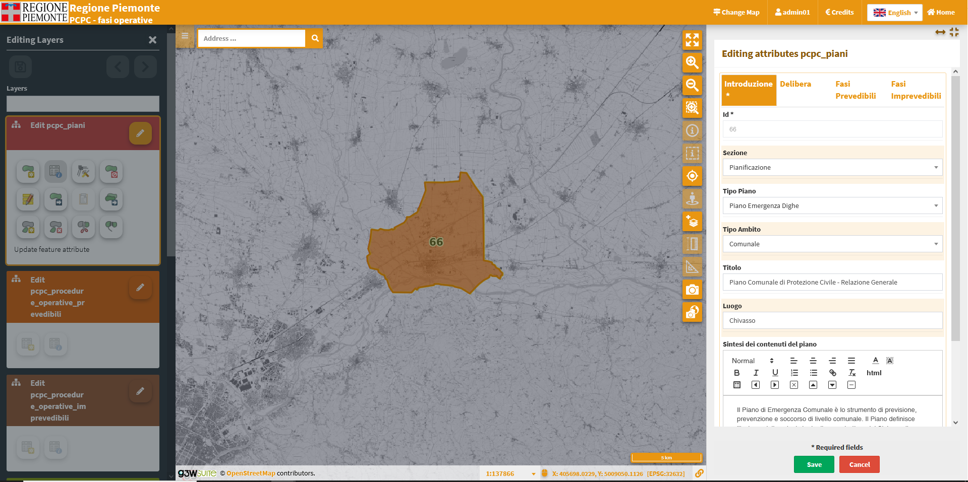
The function implements the possibility of correctly managing the editing of overlapping geometries, defining the exact geometry on which to operate.
The function allows you to copy and paste with geometries of different layers (WFS included).
As in QGIS the geometry of the source layer must be selected to be pasted into the destination layer.
Attribute copy management follows the same rules adopted on QGIS Desktop.
As in QGIS the default values are displayed in the form during editing and not only after saving.
The ‘Apply default value on update‘ option is now also managed.
All non-geometric expressions handle this option, while for geometric expressions the functionality is limited to the following: $area, $perimeter, $length, $x, $y $geometry.
The result of the expression can also be dependent on the values of other fields on the form.
Filter expressions associated with the ‘Value relation‘ widget are correctly inherited from the QGIS project.
The expression-based filter can also be dependent on the values of other fields on the form.
The text type fields manage the multiline and html options defined on the QGIS project.
HTML management is based on a simple WYSIWYG text editor.
in case of numerous editable layers, a compact filter allows to reduce the list to the layers of interest only.
The use of the disk icon to save the editing changes will not ask for confirmation but will proceed directly to the saving as on QGIS.
In case of features of a layer locked by other users, the user will receive a warning message when starting the editing.
A richer messaging has been implemented to better understand any errors in the save phase.
The Time Series tool has undergone a refactory adapting to the new management of time layers implemented in QGIS vers >= 3.26 solving some problems related to version 3.22 LTR.
The WMS URLs added by the user can be associated with a customized noem in order to improve their subsequent management.
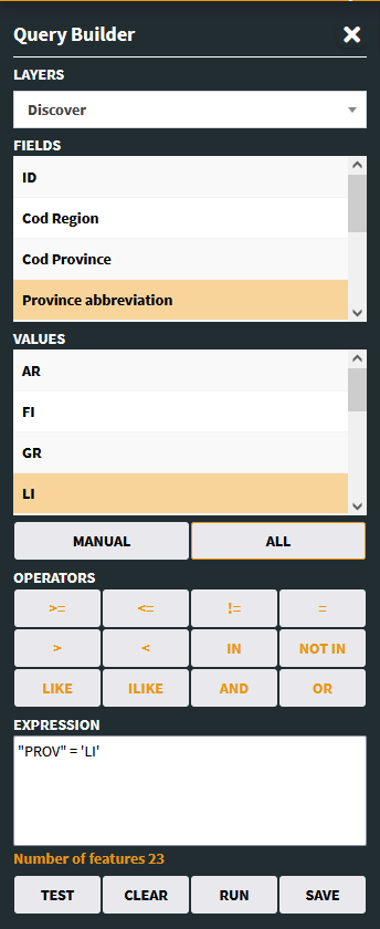
The fields exposed on the Query Builder tool are now filtered according to the settings on QGIS related to the WMS exposure.
The StreetView map control now works in two different modes: