
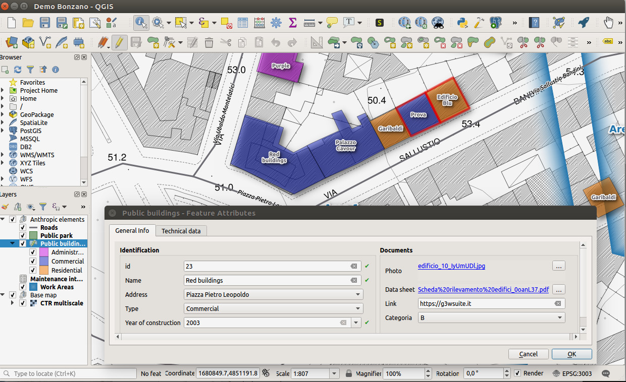
Create your QGIS project
Use data on GeoDB or file system
Publish on WebGis
Customize access portal and map client content
Create management environments and define their administrators
Activate the functional modules you need
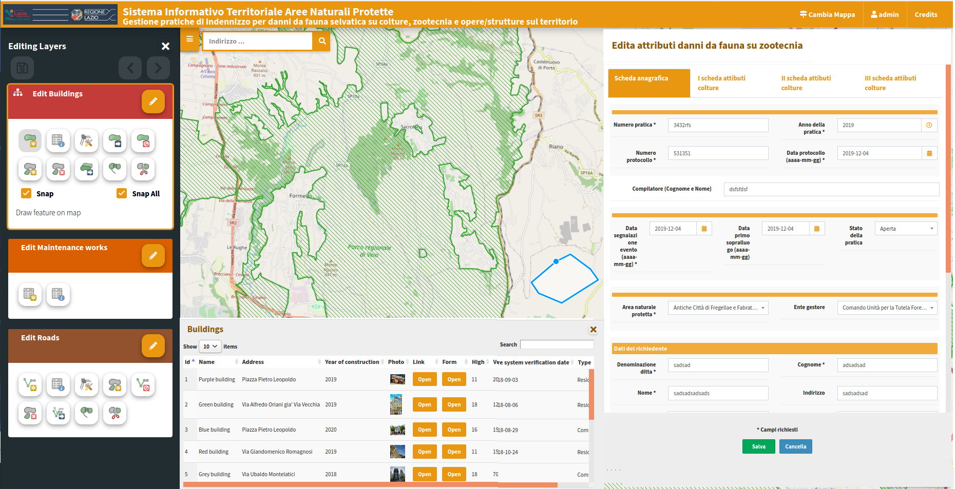
Geometric and attribute editing also on 1:1 and 1:N relations
QGIS API based editing
Form and editing widgets inherited from QGIS project
Feature lock for multi-user editing
Geographical and alphanumeric constraints that can be customized for individual users

Define users, groups and roles to differentiate management, access, online editing and functional modules
Integration with QGIS API to make it easier to include many features of the desktop component
Customizable searches
Simple and Atlas print layout
Time series animation
WPS module integration
CSW service form INSPIRE metadating
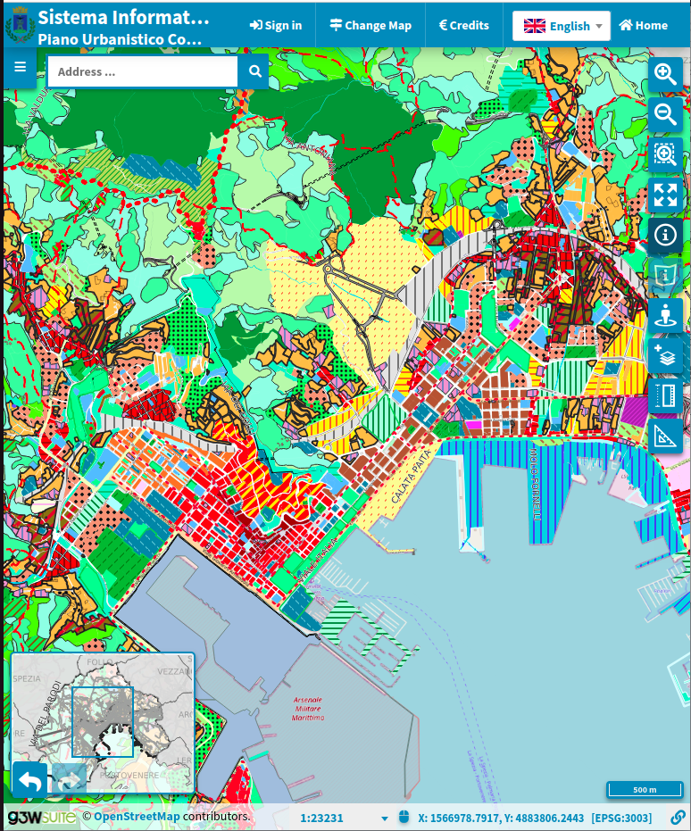
Responsive client for desktop and tablet
Web editing also in offline mode
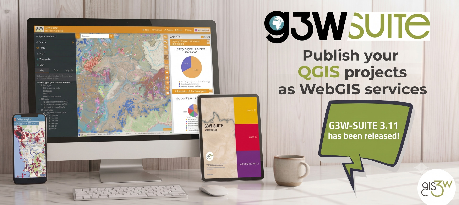
G3W-Suite is the best solution for publishing and for WebGis service management by every kind of user and for every different need.
The infrastructure allows to directly publish OS QGIS-made cartographic projects, while maintaining their graphic and informative features.
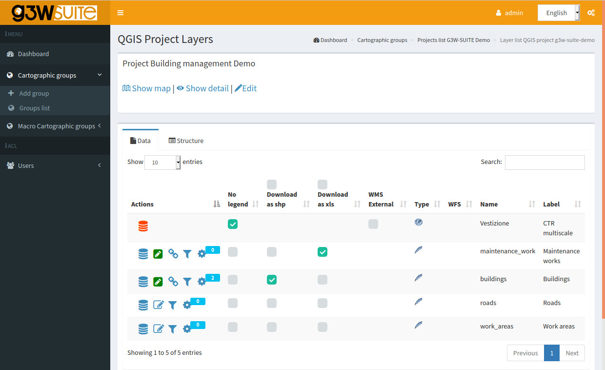
The Admin dashboard allows the managing of access authorizations and the activation of functional modules, based on each different need.
The web editing function allows you to transform your QGIS projects into web cartographic management.
Create your QGIS cartographic project by using your data
Personalise your project by defining project structure, join and 1:N relations, editing form and widgets, interactive charts (DataPlotly integration), print layout and every other graphic and functional feature
Upload and upgrade your data in your favourite format (SQLite/SpatiaLite, GeoPackage, Shapefile, Virtual layer…)
Use PostGreSQL/PostGis, Oracle Spatial and MSSQL DB data
Access your own web portal to publish your projects as WebGis service
Manage your projects independently by defining users, editing permissions and constraints, interactive graphics, search methods and activating the most useful features for your management system
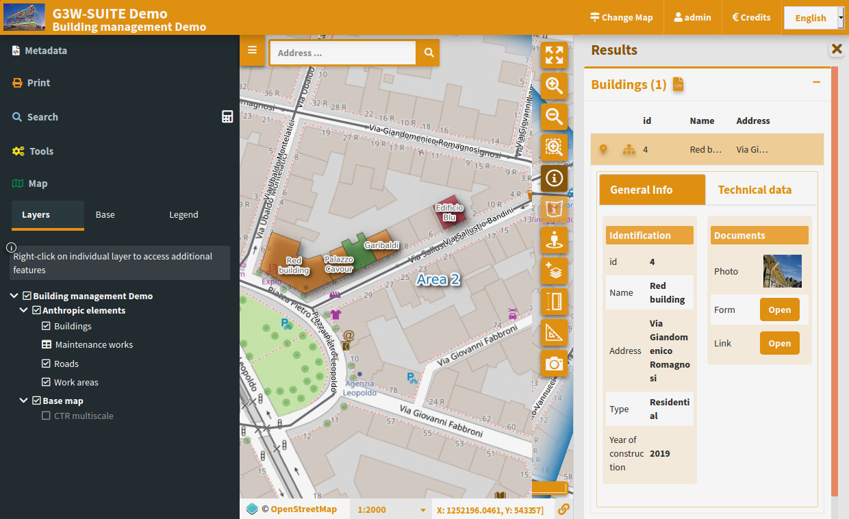


Geographic search tools and auto-zoom functions
Base maps (OSM, GoogleMaps, Yahoo, Bing …)
Printing based on print layouts (Atlas support) associated with the QGIS project
Visualization of graphs made with the QGIS DataPlotly plugin
Query Builder for custom searches
Links to web and multimedia content
On-the-fly adding vector layers (.shp, .kml, .geojson, csv…)
Display data based on join and 1:N and N:M relations
Thematic cartographic conteiners for the structured management of the WebGis services
Complete graphic and function correspondence with QGIS projects
Graphic interface for the creation of search functions
Cache management and base layer creation from WebGis services
Using your PostGreSQL/PostGis, Oracle Spatial or MMSQL DB
FileManager for your SQLite/SpatiaLite, GeoPackage, Shapefile, Virtual Layer…
Creation of users (individuals and groups) and management of access permissions
Management of on-line editing permissions on individual layers
Alphanumeric constraints based on SQL and GIS expressions for creating displayand editing filters
Geo-constraints for creating display and editing filters
Raster and vector Time series and Temporal charts
WPS services integrable
CSW service for INSPIRE metadatation
Do you need support for installation in house or as a cloud service?
Do you need operational support and training?
Are you interested in the development of specific modules for your needs?