Project: G3W-SUITE
Changelog for version: 3.3
Release date: 07 October 2021
G3W-SUITE 3.3 offers an extensive list of new and improved features – the most important shown here.
In particular, the new release implements:
To date, the modules/functions are managed through the API are:
We hope you enjoy this great work!
Happy mapping!
G3W-SUITE is an open source project and if you are able to, consider supporting our work through donations or contributions to the code documentation, web site and so on. Among the main funder of this version we remember:
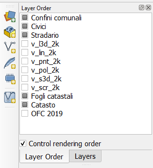
The definition on the QGIS project of the order of the layers in the map, independent of the order of the layers in the TOC, is now managed.
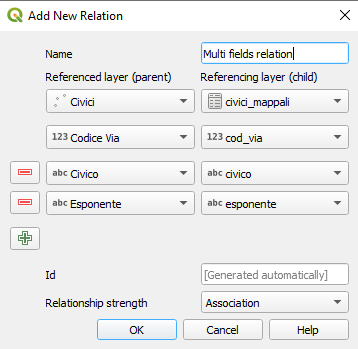
The ability to create relations based on more than one field is now managed but limited to the data consultation aspects (no searches and no editing)
It is possible to hide specific layers from the TOC based on specific users or groups of users
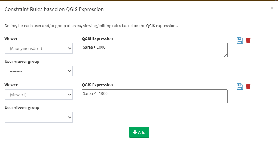
It is possible to base the various filters also on the anonymous user (public maps):
It is possible to hide, automatically, layers from the TOC when they have no records.
Useful when using filters on layers or geographic views.
Now you can hide attributes table for specific layers.
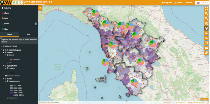
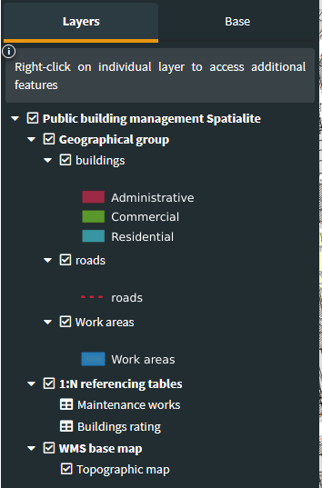
It is now possible to carry out a search based on a related table 1:N (child) and obtain the associated parent geometries as a result.
It works only on 1:N relation based on one field
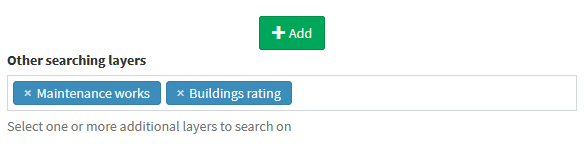
It is possible to create searches based on multiple layers with homologous fields.
The results will be differentiated according to the corresponding layer.
Especially useful in the case of multigeometric layers.
Reading/editing support on Oracle Spatial DB is extended

Through a drop-down menu it is possible to view the different combinations of layers (switched on and off) based on themes defined in the QGIS project.
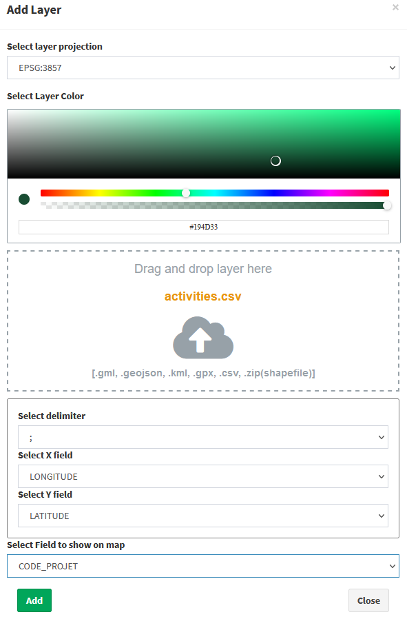
The Add layer tool now support:
It is also possible to define a field in the imported file to be used for labels,
The tools permits to export canvas area as GeoTIFF.

An option, at the publication level of the QGIS project, allows to set legend rendering position:
Following a query (single, by bbox or by polygon) or a search, it is possible to manually add/remove feaures from the list of results.
This allows you to define more precisely the list of contents to be exported in various formats or to be used as a basis for filters on tables and charts.
It is now possible to associate (at the download level) the information related to the search polygon to the geometries resulting from a QueryByPoligon
After querying a layer it is possible to copy, for each resulting features, a link dedicated to the direct zoom to the object.
Ability to define editing powers on individual layers for each user (single / group):
Now the editing form manage the QGIS expressions used as default values for individual fields in the QGIS project.
Very useful in all cases where we want the values of a field to be calculated automatically through the potential of QGIS expressions.
Map client and administration panel are available in additional languages:

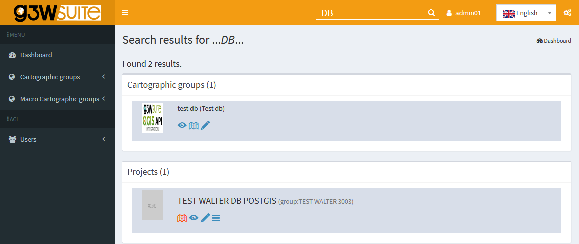
In the administration session, a search tool will allow you to find projects and cartographic groups without having to manually consult all the contents.