Project: G3W-SUITE
Changelog for version: 3.7
Release date: 13 December 2023
Among the main innovations we also remember:

G3W-SUITE is an open source project and if you are able to, consider supporting our work through donations or contributions to the code documentation, web site and so on.
Among the main funder of this version we remember:
Discover all the news about this feature on the dedicated page.
It is possible to activate the following functions at user log level:
Recovery is carried out via the email associated with the individual user

It is possible to activate a viewer-type external user registration system.
On the Administration side it will be possible to define which user groups to which new users will be automatically associated.
Recovery is carried out via the email associated with the individual user
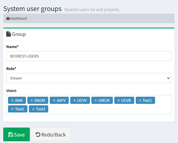
From this version it is possible to define the users belonging to a user group directly when creating the group
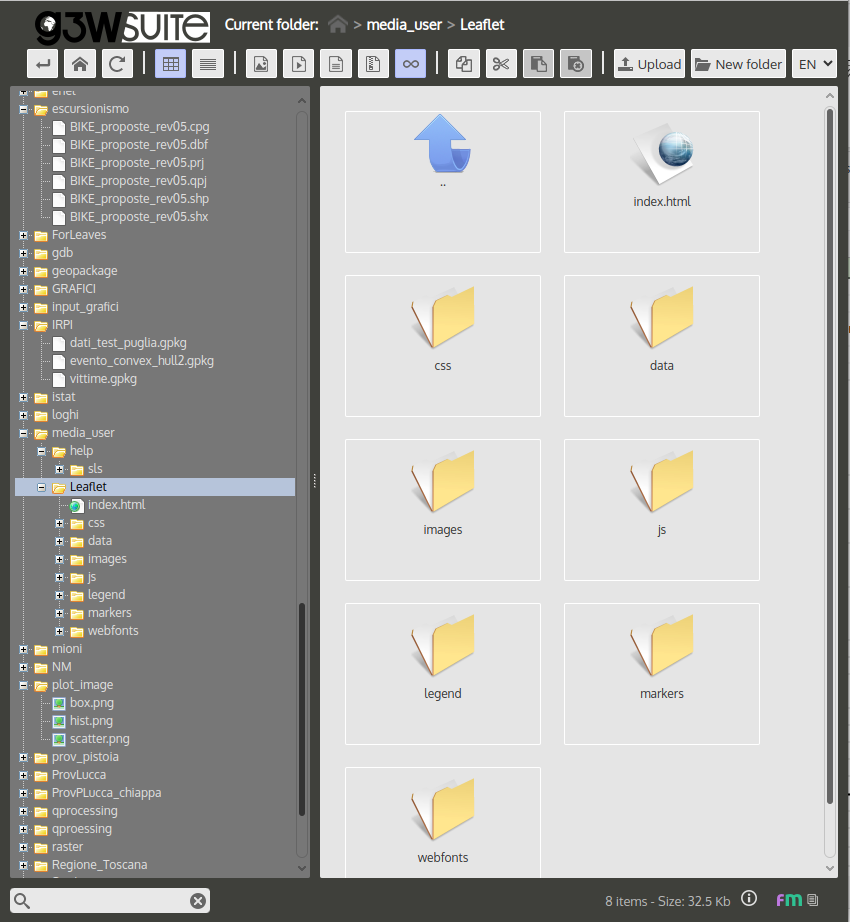
G3W-SUITE allows you to create cartographic containers of various levels and associate them, for content management, with administrators (Editor 1 and Editor2) of various levels.
Until now, only the Admin user could upload and manage geographic data on a physical file in the FileManager session.
With this version, Editor1 will also be able to manage cartographic contents on FileManager in a folder dedicated to it, simplifying content management in situations where it is necessary to set up administrator users of different levels.
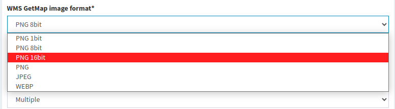
In the publication form of the webgis service it is possible to define the image format of WMS GetMap request.
The value available will be the standard formats that QGIS server can manage.
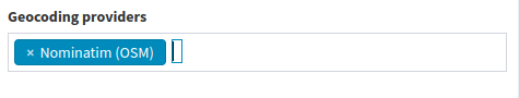
In the publication form of the webgis service it is possible to define the geocoding endpoints if the project groups have the ‘geocoding’ mapcontrol (ex ‘nominatim’) active.
PostGis rasters join the other geographic formats supported by the suite.
Inherited from QGIS project
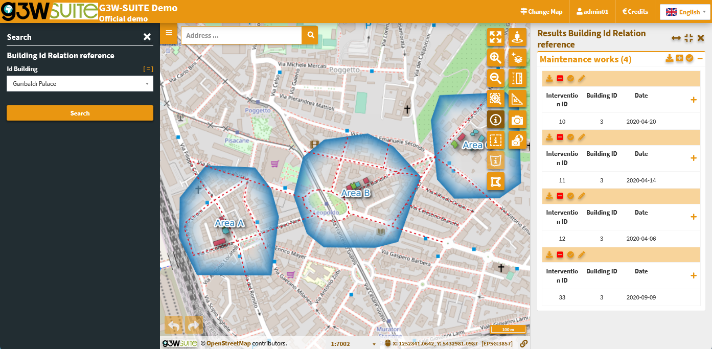
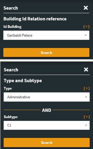
The “Relation references” widget is now managed and inherited by the suite.
It is therefore possible to define an expression to display in place of the foreign key on which the relationship is based.
The expression will be displayed:
Inherited from QGIS project
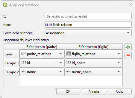
From this version the suite also manages 1:N relations based on multiple key fields
Inherited from QGIS project
It is now possible to edit tables related with 1:1 and N:1 joins starting from the parent layer.
The function allows you to:
In case you need to activate online editing on many layers, you can now do it via a new function
Inherited from QGIS project
The preparation of a search based on a field of a layer on which one of these widgets is active, on the QGIS side, determines the display of the values defined in the widget also at the level of the values on which the searches are based:
The function allowing users to set up filters on layers has been enriched.
All the filters created would propagate, with a view to consistency, on:
Furthermore, if the user is logged in, it will be possible to save the filters created and recover them in any other work session.
In the case of a 1:N relation between layers, both geometric, it will be possible to zoom in on the individual child following their visualization starting from the parent