Project: G3W-SUITE
Changelog for version: 3.1
Release date: 18 November 2020
G3W-SUITE 3.1 offers an extensive list of new and improved features – the most important shown here.
In particular, the new release implements:
To date, the modules/functions are managed through the API are:
We hope you enjoy this great work!
Happy mapping!
G3W-SUITE is an open source project and if you are able to, consider supporting our work through donations or contributions to the code documentation, web site and so on. Among the main funder of this version we remember:
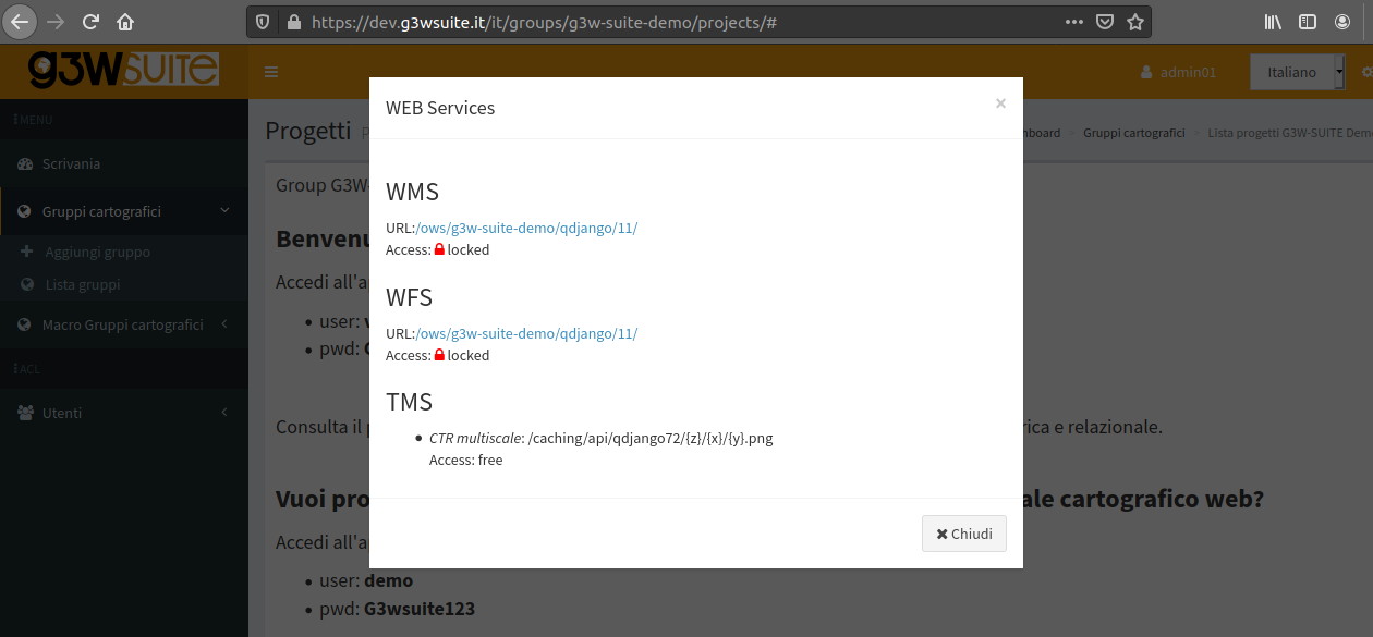
In the Administration panel, it is possible to consult the list of OGC services (WMS, WFS, WCS, XYZ Tiles) associated with each WebGis service.
The access mode is specified for each service (free or with credentials)
The creation of new base layers (XYZ Tiles) has been automated and simplified.
So you can create new base layers starting from cached layers of any webgis service and make them available for other services.
A simple pwd recovery / variation system dedicated to users has been added.
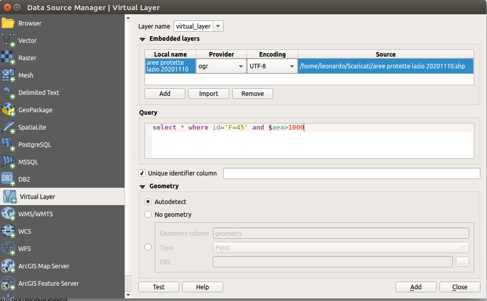
Virtual layers are now supported
View plots created using QGIS DataPlotly (a great plugin developed by Matteo Ghetta) in the cartographic client.
The module, based on the Plotly library, manages plots saved as xml through the plugin.
The plots are connected to the layers defined on the QGIS project, in this way, as for the searches and the constraints, it is possible to activate the same plots on all WebGis services in which the reference layer is present.
Plots based on visible or selected geometries will be available in the next version
More export formats, now is now possible to export from the client:
A better graphical interface, more tools, logical and comparision operators are available when you create your preset search:
The feature can be based on WMS service (default) or on QGIS API (optional)
It is now possible to consult data on 1: N relations through the attribute form defined in the QGIS project
When you publish a QGIS project we can choose if use the initial QGIS project extent as initial WebGis extent.
The maximum extension is setted from the WMS capabilities extent set on the QGIS project.
The client legend becomes interactive thanks to the compatibility with the “Filter legend by Map Content” function defined at the QGIS project level.
The query and search results window and the attribute tables are now resizable as desired to improve the display of the contents
The Metadata session has been graphically restructured and implemented with more information
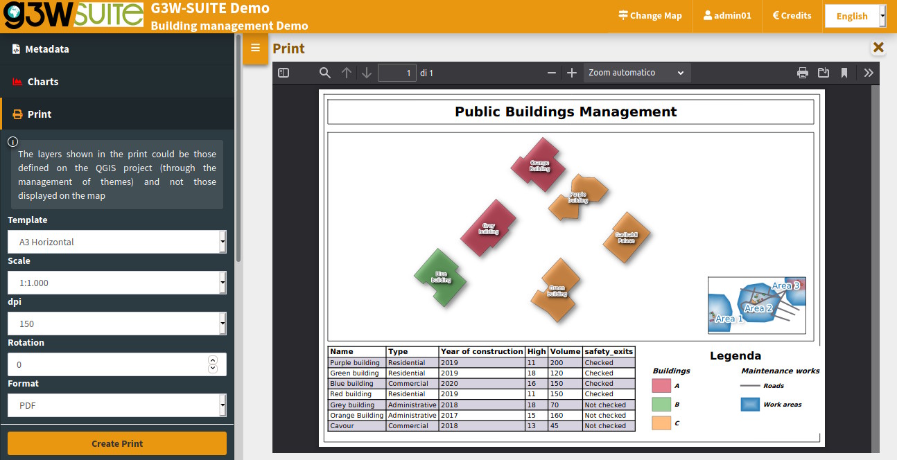
Printing based on atlases and reports are now supported.
Atlas prints are available both from the generic print session and from the query/search result forms.
Print layouts with multiple map items and panoramic maps are now supported
New editing functions are implemented:
The editing widget Value Relation is now associated with a pick layer tool to simplify the connection between the data
It is now possible to activate the snap function also between layers and no longer only in intralayer mode .