Project: G3W-SUITE
Changelog for version: 3.0
Release date: 30 June 2020
G3W-SUITE 3.0 brings an extensive list of new changes and a lot of polishing of existing features – the highlights of which we will try to cover here.
In particular, the new release was affected by an important code restructuring work that led to a first integration with the QGIS API (a great work of Alessandro Pasotti).
This integration concerns the management in visualization, interrogation, consultation and editing to the main formats supported by QGIS.
G3W-SUITE is an open source project and if you are able to, consider supporting our work through donations or contributions to the code documentation, web site and so on. Among the main funder of this version we remember:
The refactoring based on the QGIS API has brought the potential of QGIS desktop into G3W-SUITE.
The management, analysis and editing of vector data is now much simpler and safer since it is entrusted to QGIS itself.
In fact, this has allowed us to circumvent all the limitations that G3W-SUITE had in the management of raw vector data, limited to a series of specific providers (PostGreSQL/PostGis and SpatiaLite).
An important novelty that characterizes this version of G3W-SUITE is the complete integration of the OGC functionalities of QGIS-Server into G3W-SUITE.
The capabilities and properties of QGIS server like all the services supported by him WMS WFS, WCS etc are now managed and controlled by G3W-SUITE through the QGIS API.
From this version, G3W-SUITE no longer acts as a proxy to the FCGI instance of QGIS Server, but works itself as an OGC Server.

Now caching layer module is into G3W-SUITE core.
It is no longer necessary to install the module separately.
Now filemanager module is into G3W-SUITE core.
It is no longer necessary to install the module separately.
Now it is possible manage in a multilingual way.
Thanks to the integration with the APIs of QGIS it is now possible to manage the main formats (geographically and not) supported by QGIS Server:
reading and editing mode
reading mode

It is now possible to export from webgis:
A query builder layer is now available in che client.
You can create/manage your personal query directly on the client.
The query is saved on browser cache and so available on all the work session.
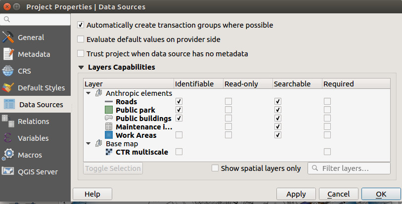
In G3W-ADMIN it is now possible to set alphanumeric/expression display constraints on the different layers present in the individual WebGis services.
This function allows users to view only the features according to the constraints associated with them.
You can set different constraints for the various users using:
In addition to the possibility of automatically inheriting the structure of the attribute forms, the associated editing widgets and the management of 1: N relations, from today it is also possible to define from the QGIS project:
It’s now possible to set geographical editing constraints on the different layers present in the individual WebGis services..
This function allows users to create/edit only the features of the layer being edited that fall within the specific geometries of a second poligon layer.
You can set different constraints (using provider language or SQL) for the various users enabled for editing.
In G3W-ADMIN it’s now possible to set editing alphanumeric/expression constraints.
This function allows users to create/edit only the features according to the constraints associated with them.
You can set different constraints for the various users enabled for editing, using:
New editing functions are implemented:
The transaction group management QGIS function is inherited in WebGis editing.
Use transaction group to edit, save or rollback multiple layers changes at once.
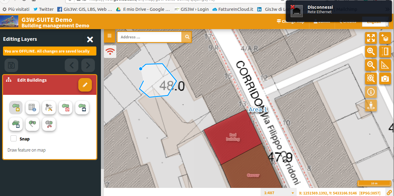
Off line editing support is implemented.
Now you can edit your data on mobile device without active connection.
After activating the ‘editing’ feature in the presence of an internet connection, it is possible to continue editing even with no network coverage.
Changes made to the data are temporarily saved in the browser’s storage system.
The return of the network connection will automatically save the changes made on the server.